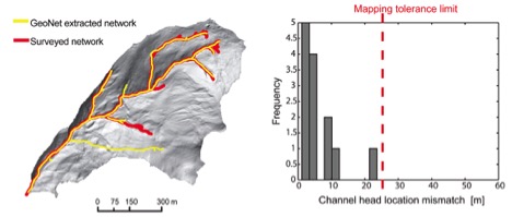
 Research Project Full Title: A GeoNet-based approach to hydro-flattening
Principal Investigator(s): Paola Passalacqua
Sponsor(s): U.S. Department of Agriculture
Full Abstract: GeoNet is an open-source software that extracts channels, channel heads, and channel morphology automatically from lidar data. The software combines non-linear filtering (to remove small-scale variability), a statistical analysis of curvature (to identify likely channelized pixels), and geodesic minimization principles (to extract channel centerlines). Once the channel network is extracted, cross sections, and channel bank locations, and water surface elevation are automatically identified. Breaklines are obtained by simply connecting the bank locations (on the left and on the right) and saving them in shapefile format. Attention will have to focus in ensuring connectivity at junctions and across tiles; an approach can be developed and added to the current capabilities of the software.
